Kayak Trip Planning - Bohuslan Coast

Please excuse my lack of Swedish (a long journey with Google Translate to get here!).

We are planning to sea kayak the Bohuslan Coast in June.

Can anyone help with my planning?

> Coastal maps or charts

> Pitching tents on bare granite?

> Risk factor from ticks

> Operation of marine VHF

> Means of getting weather forecasts at sea

> Mobile phone network coverage

> Smuggling whisky :)

Any help appreciated.

Muir
 
My view

> Coastal maps or charts
I prefer the standard land-map called "Gröna kartan" as you can get a good view of the topography, more useful than Swedish seacharts which normally lack that information Gröna Kartan Isacsson available printer onntough water resistent Tyvek fr.o.m. Utekartan or Calazo

> Pitching tents on bare granite?
A free standing dome tent gives you the perfect freedom. Most places that are soft enough for pegs is normally low hence that's where the water will be found during rain

> Risk factor from ticks
No to harsh on the west coast. By a ticks-picker from the local chemist an take them away asap. A good think is to check yourself at bedtime. Don't worry about this

> Operation of marine VHF
Ok if you have the correct international permission but I wouldn't bother with VHF as mobile coverage normally is good

> Means of getting weather forecasts at sea
Can you get it on the VHF in English? If you have a smartphone yr.no is a very good way. Or ask a yachtsman you meet, they will be happy to support you in English

> Mobile phone network coverage
Normally good along the coast

> Smuggling whisky
Yes be all means!


Any help appreciated.

Muir
 

Lästips

Europas okända pärlor – 10 vandringar bortom turiststråken

Sugen på att packa väskan och vandra utanför Sverige? Då är den här listan för dig!

Stabil sikt för skarpa naturupplevelser – Nikons nya kikare lyfter blicken

STABILIZED S ger stadig bild i varje ögonblick. Skarp optik, låg vikt och lång batteritid gör dig redo att se mer.

Vinn skor och startplatser till Merrell Göteborg Trailrun för två!

Delta i Göteborgs stora trailfest den 6 september! Nu har du chansen att vinna både startplatser och nya MTL ADAPT från Merrell åt dig och en vän.

Prisade prylar: här är vinnarna av Scandinavian Outdoor Award

Bland de vinnande produkterna finns bland annat en slittålig lättviktsryggsäck och en designklassiker i rostfritt stål.
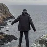
Kayaking the Bohuslän coastline is excellent. Easy access and beautiful. Most parts are easily travelled. Some parts are more exposed to hard winds and seas. The tide is very limited although storms may have some effect on water level.

I would suggest using "land" maps rather then nautical charts. The nautical charts do not include land features that are important for choosing camp grounds. Smooth, flat rock or even sand or grass can be identified on land maps.
Map info: http://www.lantmateriet.se/en/Maps-and-geographic-information/Maps/Terrangkartan/Tryckt-Terrangkarta-/

Pitching tents on granite. I suggest, if you have the option, to use a self-supporting tent. A dome or something like that. A tunnel-type tent also works but you would have to use rocks and other stuff to support. Thick mattress/ground cover is a good idea. Sleeping on rock is hard.

Ticks are not a big risk factor. There are some ticks and incidence of lyme disease and TBE (tick-borne encephalitis) is incresaing although quite uncommong. You may consider vaccination to protect from TBE.

VHF is not really required in my mind. A cell phone will work excellent. If you have a VHF you can bring it as a backup I guess.

Swedish national radio provides weather forecasts several times daily. Also for coastal weather. This is only swedish.
SMHI provides weather forecasts in English online. SMHI weather in English

Cellphone coverage is excellent. Shouldnt be a problem.

Remember to fill up on freshwater when you can. You will find good water in any harbour or town but almost none in the uninhibited parts of the archipelago. There are toilets and garbage disposal at the most popular spots in the archipelago. Please use them.

Excellent kayaking outfitters:
http://www.kajakcenter.com/en/
http://nautopp.se/

Good luck!
Pelle
 
Excellent advice above. It is good that you plan to go kayaking in June as July is much more crowded. My favorite part of the Bohuslän area is north from Fjällbacka and Väderöarna and including the Koster Ilands.

Thure
 
Drikkevand?

Hej derude,

denne post er lidt gammel, men jeg stiller alligevel lige mit spørgsmål her, da det også vedrører planlægning af en kajaktur til Fjällbacka Skärgård:

I skriver at man kan få vand i havnene, men mener I dermed i fastlandsbyerne langs kysten eller rent faktisk på øerne ude i selve skærgården? Kan vi regne med at tanke frisk vand hver dag - og i så fald på hvilke øer? Det er jo dog en ret vigtig detalje... Hvis vi altså gerne vil have andet i kajakken end drikkevand :)

På forhånd tak og mange hilsner fra København!
 
Förutom fastlandet, så på alla öar med fast bosättning är det inga problem med vatten. Alltså Koster, Gullholmen, Käringön, Marstrand osv. Även vissa små hamnar o campingplatser funkar. I Fjällbacka är det nog enklast att tanka vatten där man lägger i, och sen får man gå in till Havstenssund, Hamburgsund eller någon annan by som ligger längre ut, när det börjar ta slut.
Om du inte paddlar extremt långsamt finns det tillgång till både dricka o mat typ varje dag i hela Bohuslän.. :)

/ Ulf
 
Hej Ulf,
1000 tak for svar, så ved vi besked, det er lidt svært at forestille sig det hele herhjemme fra.

Vi glæder os supermeget til en uge i jeres skønne skærgård og ønsker alle en fin kajaksommer !
 

Få Utsidans nyhetsbrev

  • Redaktionens lästips
  • Populära trådar
  • Aktuella pristävlingar
  • Direkt i din inkorg

Lästips