
The part of the site for people who like statistics and for those who want to try out some of the routes I've cycled.
Many parts of the world is full of interesting mountains. I've always been interested in diagrams and statistics, therefore I've tried to keep a detailed logbook about the topography. Most of the diagrams etc. are self made, some have been completed with help from other travelers who have been in the same areas.
Dali - Lhasa (Yunnan-Xizang/Tibet, China)
Kathmandu - Kashi/Kashgar. "The Northern Route" via Saga - Tsochen - Gerze - Shiquanhe (Nepal - Xinjiang, China)
Kashi/Kashgar - Kathmandu "The Southern Route" via Mt Kailas (Xinjiang, China-Nepal)
Lhasa - Kathmandu (China - Nepal) Two alternative routes.
The Golmud Highway Golmud - Lhasa. (Qinghai - Xizang/Tibet, China).
Aksu - Yining (Tienshan, Xinjiang, China).
Bamda - Riwoqe. (A detour from the Dali - Lhasa Route in Eastern Tibet).
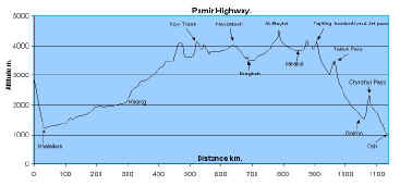
The Pamir Highway (Tajikistan - Kirgizstan)
Osh - Kochkor (Kirgizstan)
Sary Bulak - Ak-Shyrak and back to Barskoon (Kirgizstan)
Some other routes will also be mentioned here. Some distances can be a bit off, due to my laziness/malfunctioning speedometer/other reasons. If you use them as a "guide", be a bit careful and don't trust them too much, they are pretty crude.
The Ultimate page for all
climbing/uphill fanatics!
All
major passes in Europe, complete with search engine, graphs, etc!
All graphs on the following pages are minimized, click on them to get a bigger one and more details.
RCC = Road
Construction Camp
LP = Lowest
Point
HP = Highest
Point
Rest. =
Restaurant
Hot. = Hotel
TO = Turn Off
Everyt. etc. =
You can find hotels, shops, restaurants etc.
X = Measure
point, usually in the middle of nowhere
Wat = Water
Vill. = Village
CP = Check
Point
Plat. = Plateau
Settlm. =
Settlement
YTK=Yang-Tze-Kiang
There may be some other ones...use your imagination.